
1. The Gateway to the North: Navigating the Hazara Motorway into Kaghan
The modern overland expedition into Kaghan Valley begins with an engineered transition from the rolling plains of Punjab and Khyber Pakhtunkhwa to the Himalayan foothills. Modern transit relies heavily on the Hazara Motorway (M-15), which cuts travel time significantly by bypassing dense urban congestion in Abbottabad and Mansehra.
Islamabad / Rawalpindi (M-1 Motorway)
               │
               ▼
Hazara Motorway (M-15) via Havelian & Abbottabad Tunnels
               │
               ▼
Mansehra Interchange ──► N-15 National Highway
               │
               ▼
Balakot: The Historic Gateway to Kaghan Valley (Elevation: ~980 m)
Exiting the expressway at Mansehra positions travelers onto the N-15 National Highway, the arterial lifeline of the valley. Balakot functions as the geographical gateway where the climate changes dramatically. Here, ambient city heat yields to cool, moist alpine air channeled down by the Kunhar River.
Historically rebuilt after the devastating 2005 earthquake, Balakot is where travelers refuel, check vehicle suspension systems, and acclimate before ascending through Kawai, Paras, and Mahandri toward the upper alpine basin.
2. Along the Kunhar River: Geography and Hydrology of Kaghan
The Kunhar River (also known historically as the Nain Sukh) is the hydrographic backbone of Kaghan Valley. Originating high near Lake Lulusar at an elevation above 3,400 meters, this glacier-fed torrent carves an 166-kilometer V-shaped alpine valley before merging with the Jhelum River near Muzaffarabad.
Glacial Melt (Lulusar Lake & High Peaks)
                 │
                 ▼
Upper Kunhar Rapids (Steep gradient, high velocity, Class IV–V water)
                 │
                 ▼
Naran Valley Basin (Braided gravel beds, trout breeding grounds)
                 │
                 ▼
Lower Gorge (Deep incision, hydropower corridors, confluence with Jhelum)
The hydrology of the Kunhar dictates the valley’s microclimate and economic activities:
- Glacial Runoff: Seasonal snowmelt between May and July produces swift currents and high sediment loads, carving deep granite gorges along the road.
- Aquatic Ecology: The cold, oxygen-saturated water sustains wild Brown Trout (Salmo trutta) and Rainbow Trout (Oncorhynchus mykiss), which were introduced during the early 20th century.
- Erosion and Road Maintenance: The river’s steep gradient continuously undermines riverbanks, requiring highway authorities to build extensive gabion walls and check-dams along the N-15.
3. Naran Town: High-Altitude Base Camp and Cultural Epicenter
Situated at an elevation of approximately 2,400 meters (7,900 feet), Naran has transformed from a sleepy seasonal pastoral settlement into the bustling commercial capital of Upper Kaghan. Operating largely from May to October, the town serves as the operational staging ground for all high-altitude treks, jeep safaris, and lake excursions.
| Infrastructure / Feature | Operational Description | Travel Consideration |
| Accommodation | Riverside glamping, family lodges, mid-tier hotels | Advance booking essential during June–August peak season |
| Bazaar Logistics | Woolen markets, trekking gear shops, pharmacies | Essential supplies must be stocked here before heading north |
| Culinary Offerings | Freshly caught trout, wood-fired chapli kebabs, chai | High demand at night; cold temperatures set in after sunset |
| Transport Hub | Local 4×4 Willys & CJ-7 Jeep Union stand | Fixed-rate fares regulated by the local transport authority |
Beyond its retail facade, Naran remains culturally rooted in Gujjar and Swati pastoral rhythms. During the spring melt, Gujjar transhumance pastoralists drive herds of sheep and water buffalo through town toward high summer pastures, offering visitors a firsthand look at centuries-old migratory traditions.
4. The 4×4 Trail to Saif-ul-Mulook: High-Altitude Terrain and Logistics
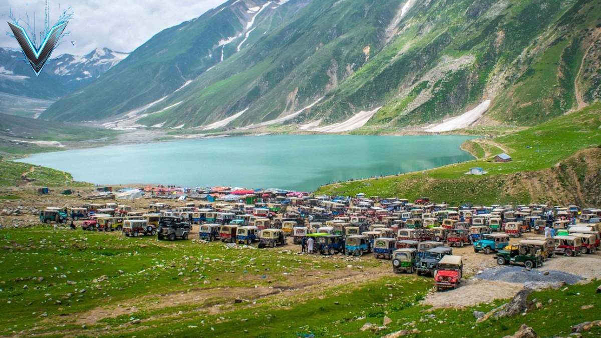
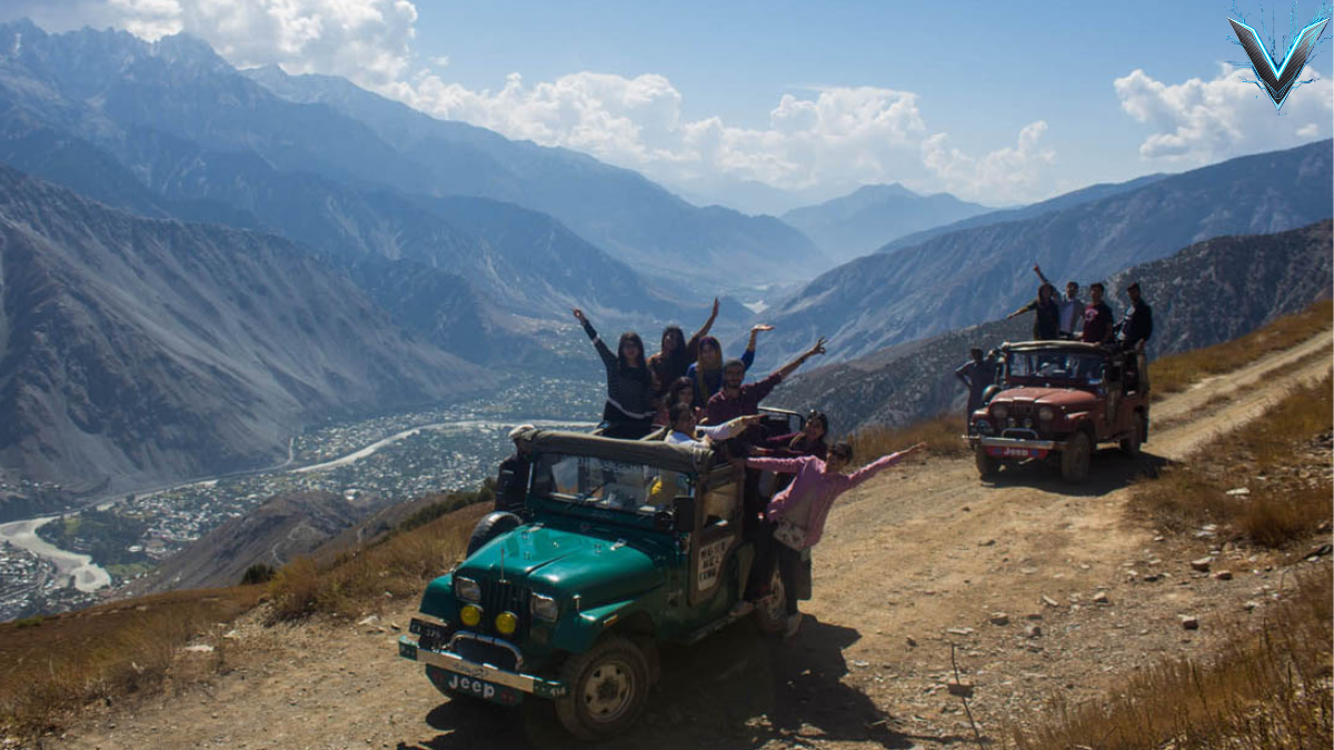
Reaching Lake Saif-ul-Mulook from Naran requires navigating an eight-kilometer mountain jeep track that gains over 800 meters of elevation in under 40 minutes. The track is cut into loose moraine, fractured slate, and vertical scree slopes, making it impassable for conventional road vehicles.
Naran Town (Elevation: 2,400 m)
             │
             ▼ (Steep gradient, hair-raising hairpin bends, scree patches)
The Glacier Passages (Seasonal snow bridges requiring careful spotters)
             │
             ▼
Saif-ul-Mulook Ridge & Security Checkpost
             │
             ▼
Lake Shore Basin (Elevation: ~3,224 m / 10,578 ft)
The trip is conducted via short-wheelbase 4WD jeeps (modified Toyota Land Cruisers, classic Willys, and Mitsubishi Pajeros) driven by local drivers accustomed to the terrain:
- Vehicle Dynamics: Drivers routinely lock differentials into low-range 4WD to climb loose switchbacks with inclines exceeding 18%.
- Environmental Hazards: Early season travel involves driving across active snow bridges that span glacial melt torrents. By mid-summer, minor rockfalls and vehicle dust become the primary challenges.
- Trekking Alternative: For acclimated hikers, a parallel footpath winds through the pine and birch line on the opposite side of the gorge, taking roughly 2.5 to 3.5 hours of continuous uphill hiking.
5. The Jewel of the Valley: Limnology and Ecology of Lake Saif-ul-Mulook
Resting in a natural amphitheater at an altitude of 3,224 meters (10,578 feet), Lake Saif-ul-Mulook is an oligotrophic alpine glacial lake. Formed through glacial moraine damming during the terminal phases of the Pleistocene epoch, the lake collects snowmelt from surrounding cirques and peaks.
Surrounding Glaciers & Snowpack (Malika Parbat Cirque)
                         │
                         ▼
Sub-Surface Infiltration & Glacial Torrents
                         │
                         ▼
[Lake Saif-ul-Mulook Water Body: Depth up to ~34 m]
                         │
                         ▼
Surface Spillway Outlet (Feeds the Saif-ul-Mulook Nullah into Kunhar)
The lake’s physical characteristics directly shape its distinct appearance:
- Water Chemistry and Hue: The water is cold, clear, and poor in plant nutrients, giving it a deep emerald-turquoise hue caused by suspended glacial flour (finely ground rock particles) that scatter sunlight.
- Alpine Flora: The slopes above the tree line support alpine meadow flora, including dwarf juniper, wild sage, alpine gentians, and medicinal Himalayan herbs.
- Avian Wildlife: During spring and autumn migration windows, the lake acts as an essential resting stop for high-altitude waterfowl traversing the Central Asian Flyway.
6. Myth, Romance, and Folklore: The Tale of Prince Saif and Badri-ul-Jamal
Lake Saif-ul-Mulook’s cultural stature is inextricably linked to oral folklore immortalized by the 19th-century Sufi poet Mian Muhammad Bakhsh in his epic verse Saif-ul-Mulook. The tale blends mystical Sufi allegory with regional high-altitude folklore.
The legend recounts the journey of Prince Saif-ul-Mulook of Persia, who, captivated by a dream of the fairy princess Badri-ul-Jamal, traveled for years to reach this remote lake. Supported by dervishes and supernatural talismans, the prince discovered the fairy queen bathing in the glacial waters alongside her celestial companions:
Prince's Vision / Quest ──► Trials & Spiritual Discipline (Sufi Allegory)
                                        │
                                        ▼
             Discovery of the Enchanted Alpine Basin
                                        │
                                        ▼
Rival Demon's Fury (Deo Safid) ──► Floodwaters create Kaghan's Lakes
                                        │
                                        ▼
Triumph of the Lovers ──► Eternal Haven beneath Malika Parbat
When an opposing white demon (Deo Safid) discovered their romance, he unleashed floods by tearing through local glaciers, inadvertently sculpting the surrounding topography and nearby high-altitude tarns. To this day, local guides share tales of the fairies descending onto the water’s surface on moonlit nights, keeping the romance woven into Kaghan’s cultural identity.
7. Malika Parbat: The Queen of Mountains
Dominating the southeastern horizon directly behind Lake Saif-ul-Mulook stands Malika Parbat (Queen of the Mountains). At 5,290 meters (17,356 feet), it is the highest peak in the Kaghan Valley, its jagged, ice-covered pyramid presenting a stark contrast to the smooth lake surface below.
                       ▲ Malika Parbat Peak (5,290 m)
                      / \
                     /   \ (North Face: Avalanches & Hanging Seracs)
                    /     \
                   /       \
                  /=========\  Hanging Glacier & Crevasse Fields
                 /           \
                /             \
Lake Basin (3,224 m) ────────── Base Camp Approaches (Technical Moraine)
From a mountaineering perspective, Malika Parbat is technically demanding and notoriously dangerous:
- Geological Profile: The peak is formed from unstable slate, brittle shale, and heavily fractured granite, which causes frequent rockfall along standard climbing routes.
- Climbing History: First summited in 1940 by British mountaineers Colin Kirkus and Arthur McPhillips, the peak has seen very few successful ascents since due to steep hanging seracs, treacherous couloirs, and unpredictable local weather fronts that roll in from Kashmir.
- Visual Drama: For photographers, the mountain serves as the definitive backdrop to Saif-ul-Mulook, with morning light illuminating its sheer north face and reflecting off the calm water.
8. Beyond Saif-ul-Mulook: Exploring Upper Kaghan to Babusar Pass
While Naran and Saif-ul-Mulook are the primary tourist hubs, continuing further north along the N-15 reveals the wilder, higher-altitude landscapes of Upper Kaghan, culminating at the high Himalayan border.
Naran (2,400 m) ──► Batakundi ──► Jalkhad ──► Lake Lulusar (3,410 m) ──► Babusar Pass (4,173 m)
Key waypoints along this northern corridor include:
- Batakundi and Jalkhad: Lush pastoral farming settlements where red potatoes and mountain peas are cultivated, serving as launching points for routes toward Azad Kashmir’s Neelum Valley via the Noori Top track.
- Lake Lulusar: A dramatic crescent-shaped alpine water body wrapping along the road. Far larger than Saif-ul-Mulook, this cold, wind-swept lake serves as the primary headwater for the Kunhar River.
- Babusar Pass (4,173 meters / 13,691 feet): The geographic climax of the Kaghan Valley highway. Babusar marks the boundary between the Khyber Pakhtunkhwa province and Gilgit-Baltistan. On clear mornings, travelers standing on the pass can catch views across the Indus gorge toward the snowfields of Nanga Parbat.
9. Trekking and Wilderness Circuits of Kaghan Valley
Beyond the vehicular routes, the Kaghan Valley offers some of northern Pakistan’s most rewarding intermediate-to-advanced trekking circuits, leading into pristine alpine wilderness far removed from the busy bazaars of Naran.
| Trekking Route | Grade / Duration | Maximum Altitude | Defining Landmark |
| Ansoo Lake Trek | Strenuous (8–10 hours roundtrip from Saif-ul-Mulook) | 4,240 m (13,910 ft) | Teardrop-shaped glacial tarn resembling a human tear |
| Dudipatsar Lake Trek | Moderate–Strenuous (3–4 days return from Besal) | 3,800 m (12,467 ft) | “White Lake” surrounded by rolling green alpine meadows |
| Saral Pass Circuit | Advanced (4–5 days traverse) | 4,100 m (13,450 ft) | Connects Upper Kaghan to the Neelum Valley wilderness |
The trek to Ansoo Lake is particularly demanding. Departing from the shores of Saif-ul-Mulook, hikers ascend steep moraine fields and traverse loose scree to reach a high saddle. The lake below sits enclosed within an amphitheater of black rock, its surface often covered by floating ice sheets even into late July.
10. Conservation Realities: Preserving Kaghan’s Fragile Alpine Ecology
The rapid surge in seasonal tourism over the past two decades has placed acute ecological pressure on the delicate alpine ecosystems of Kaghan Valley and the Saif-ul-Mulook catchment basin. Sustainable stewardship has shifted from a theoretical goal to an immediate necessity.
Unregulated Mass Tourism ──► Single-use plastic waste & fuel emissions
                                         │
                                         ▼
Fragile Alpine Meadow Degradation ──► Soil compaction & loss of native flora
                                         │
                                         ▼
Glacial Hydrology Pollution ──► Degradation of Kunhar River & downstream fisheries
Key ecological challenges and mitigation strategies include:
- Solid Waste Remediation: Thousands of daily visitors generate substantial amounts of single-use plastics, requiring community-led cleanups and strict municipal trash enforcement at lake access points.
- Emission and Traffic Controls: Restricting internal combustion 4×4 access near the immediate shoreline of Saif-ul-Mulook to reduce oil runoff and soot deposition on nearby glaciers.
- Ecotourism and Community Partnerships: Shifting tourist revenue into local hands encourages local communities to actively protect high-altitude wildlife, including the Himalayan snowcock, monal pheasant, and elusive snow leopard.
Preserving this glacial basin ensures that future generations can experience Kaghan Valley not as an overexploited tourist corridor, but as the pristine wilderness and legendary alpine landscape it has been for centuries.